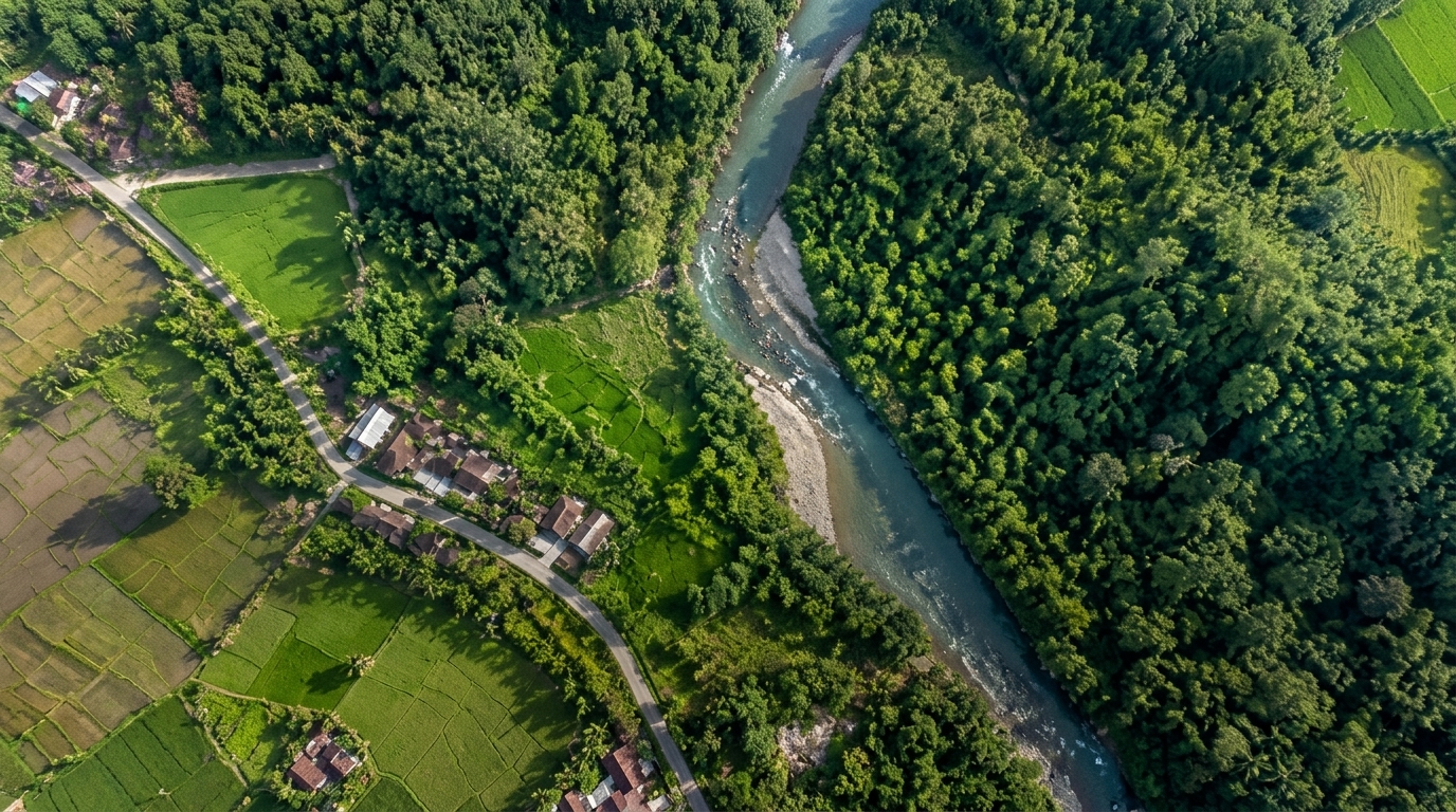
East Kalimantan Watershed & Corridor Bare-Earth LiDAR
Full-waveform airborne LiDAR acquisition penetrating multi-tier tropical canopy to model micro-drainage basins, flood plains, and civil earthwork corridors for arterial infrastructure.
We turn the view from a drone into a better understanding of the ground beneath your feet.

High-resolution aerial imagery, precisely captured and stitched into a clear view of your site.
Across an archipelago of volcanic ridges, dense equatorial rainforests, and dynamic coastlines, infrastructure and environmental decisions demand more than approximate maps.
Skyterra Nusantara bridges two complementary disciplines: the airborne precision of modern remote sensing and the grounded rigor of geodetic land survey. Our outputs integrate directly into civil engineering, hydrography, asset management, and national spatial data infrastructure.
Long-endurance UAVs, manned survey aircraft, full-waveform LiDAR, and medium-format metric cameras operating with PPK/RTK trajectory control.
SRGI 2013 geodetic monumentation, bare-earth terrain modeling, bathymetric charting, and engineering-ready BIM/GIS deliverables.
Structured across aerial capture (Sky) and surface intelligence (Terra), every capability is delivered to verifiable geodetic tolerances.
High-density, multi-return laser scanning engineered to penetrate dense equatorial vegetation and model complex bare-earth terrain.
Radiometrically calibrated medium-format aerial photography with PPK/RTK georeferencing for zero-lean urban and industrial mapping.
Photorealistic textured 3D meshes and BIM-ready point clouds for ports, bridges, energy facilities, and urban infrastructure corridors.
Seamless land-to-sea terrain modeling combining airborne green-laser bathymetry with multibeam acoustic sounding for coastal engineering.
Surface flow simulation, flood inundation mapping, slope stability analysis, and automated cut/fill volumetric audits.
Long-range BVLOS corridor surveys for high-voltage transmission lines, pipelines, railways, and forestry haul networks.
From equatorial rainforest watersheds to high-density port terminals, our deliverables provide engineering-grade spatial certainty.
Full-waveform airborne LiDAR acquisition penetrating multi-tier tropical canopy to model micro-drainage basins, flood plains, and civil earthwork corridors for arterial infrastructure.
Integrated UAV green-laser LiDAR and multibeam echo sounder (MBES) survey linking sub-surface seabed morphology with above-water container crane and breakwater assets.
Long-range VTOL LiDAR and oblique photogrammetry capturing tower geometry, insulator strings, thermal conductor sag, and automated tree-fall hazard zones.
High-cadence medium-format aerial photogrammetry delivering survey-grade stockpile volumetrics, haul-road gradient verification, and coastal sediment monitoring.
Every survey follows a rigorous four-stage geodetic pipeline. By combining calibrated airborne sensors with strict ground-truth verification, we eliminate spatial drift before analysis begins.
UAV · Manned Aircraft · USV Bathymetry
Terrain-following flight trajectories engineered around local topography, cloud ceiling, and solar angles. Simultaneous capture of full-waveform LiDAR and medium-format metric imagery.
SRGI 2013 / BIG CORS Tie-In
Tightly coupled inertial and GNSS trajectory refinement anchored to Indonesia's national geodetic reference network (SRGI 2013) and monumented ground control points.
Bare-Earth Extraction · 3D TIN Mesh
Automated and manual QA/QC point cloud filtering to separate multi-tier vegetation from true ground, paired with radiometrically balanced orthorectification.
OGC WebGIS · CAD/BIM · Volumetric Reports
Delivery of engineering-ready spatial datasets, hydrological flow models, cut/fill earthwork audits, and interactive 3D digital twins directly into client workflows.
Comparison between Multi-Return Airborne LiDAR (Logo Teal #258B80) and Passive Photogrammetry (Logo Blue #1769A6) across Indonesian vegetation regimes.
Multi-return LiDAR maintains sub-3cm vertical precision even beneath 95% equatorial forest cover.
While optical photogrammetry excels on exposed mining benches and coastal corridors, active laser pulses penetrate multi-layer foliage to lock onto true terrain elevation.
Share your project coordinates, target terrain area, or shapefile bounds. Our geodetic engineers will prepare a flight acquisition plan, GSD specification, and mobilization schedule within 48 hours.
Sudirman Central Business District (SCBD), Treasury Tower Lv. 18, South Jakarta 12190, Indonesia
Sepinggan Geospatial Sector, Balikpapan Selatan, East Kalimantan 76115, Indonesia